14 November 2025
The AI for Integrated Mobility (AIM@IISc) initiative at the Indian Institute of Science (IISc) announces the public release of UVH-26, a large-scale traffic image dataset and a suite of fine-tuned object detection models designed for Indian urban traffic scenarios.
UVH-26 comprises 26,646 high-resolution traffic images from Bengaluru’s Safe City project, annotated with 1.8 million bounding boxes across 14 India-specific vehicle classes, including two-wheelers, auto-rickshaws, light commercial vehicles, and buses. The dataset was curated through a nationwide Urban Vision Hackathon (UVH), engaging over 560 student volunteers in a crowdsourced annotation effort. Consensus ground truth was derived using Majority Voting and STAPLE algorithms to ensure high-quality annotations.
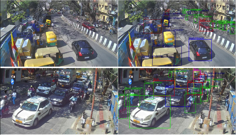
Example base images (left) and their pre-annotations with bounding box and label (right)
To complement the dataset, AIM@IISc is releasing six state-of-the-art object detection models based on YOLOv11, DAMO-YOLO, and RT-DETRv2, and fine-tuned on UVH-26. These models demonstrate up to 31.5% improvement in mAP@50:95 over COCO-trained baselines for Indian traffic scenes, underscoring the importance of contextually aligned data for intelligent transportation systems.
The dataset and models are now available on HuggingFace under open-source licenses:
Dataset: https://huggingface.co/datasets/iisc-aim/UVH-26
Models: https://huggingface.co/iisc-aim/UVH-26
Since its release on 5 Nov 2025, the UVH-26 datasets have gained attention, with over 1,500 downloads and currently ranking as the #1 trending object detection models on HuggingFace. This reflects the growing global interest in AI for mobility in the Global South.
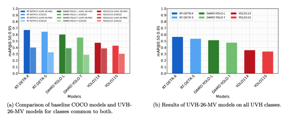
Performance comparison of UVH-26 trained models against state-of-the-art baselines
AIM@IISc invites researchers, developers, students, and policymakers to explore, benchmark, and build upon UVH-26 to advance intelligent transportation systems across emerging economies.
AIM@IISc explores the use of AI and data-driven methods, and digital twin platforms to address challenges to urban mobility in India, including traffic congestion, traffic safety, and urban planning. AIM@IISc is anchored at the Centre for infrastructure, Sustainable Transportation and Urban Planning (CiSTUP), and consists of an interdisciplinary team of faculty and researchers from CiSTUP, Department of Computational and Data Sciences (CDS), Robert Bosch Centre for Cyberphysical Systems (RBCCPS) and Centre of Data for Public Good (CDPG).
The UVH-26 initiative was made possible through the vital support of the Bengaluru City Police and Bengaluru Traffic Police (BTP), who facilitated access to the base imagery from the Safe City project. This collaborative, multidisciplinary effort was anchored at CiSTUP, and brought together faculty and researchers from CDS, RBCCPS, and CDPG. The project was further supported by IISc’s AI & Robotics Technology Park (ARTPARK), Kotak IISc AI-ML Centre (KIAC), and industry partner Capital One, with outreach contributions from ACM India Council and IEEE India Council.
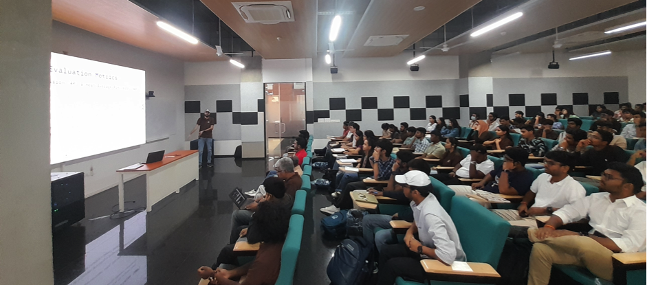
Orientation session for teams participating in the on-campus Urban Vision Hackathon
“India has always been data-poor for AI applications, especially in mobility, given the scale and complexity of Indian traffic. UVH-26 is a testament to how crowdsourced efforts by hundreds of engaged students can create high-quality datasets that rival global benchmarks. This shows the power of community-driven AI for solving local challenges. By making these datasets and model openly available, we aim to catalyse research, development and deployment of AI-driven traffic analytics for safer and smarter cities,” says Yogesh Simmhan, Associate Professor at CDS, IISc.
“We often talk about evidence-based decision support for our cities, but it really starts with good data – something we still struggle with because collecting it is expensive and time-consuming. Accurate traffic detection models can change that by using existing city cameras to generate reliable data for planning, signal control, congestion management, and safety analytics. UVH-26 can help all Indian cities, not just Bengaluru, build such datasets and enable data-driven solutions,” says Vijay Kovvali, Research Professor at CiSTUP, IISc.
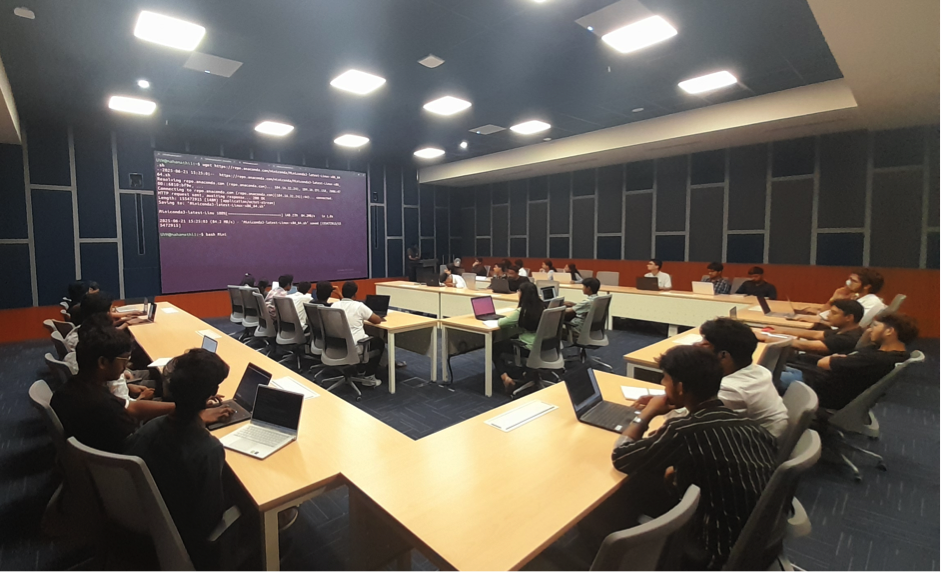
Teams training models during the on-campus Urban Vision Hackathon
“Urban mobility in India and many other countries is characterised by highly heterogeneous and disorderly traffic patterns. UVH-26 provides a much-needed traffic image dataset to accelerate research and development for measuring, modeling, and managing this complexity. It marks an important step toward evidence-based, intelligent transportation planning in India,” says Abdul Pinjari, Chair of CiSTUP, IISc.
Technical Highlights:
Dataset Size: 26,646 anonymized 1080p traffic images from 2,800 Bengaluru CCTV cameras
Annotations: 1.8M bounding boxes across 14 India-specific vehicle classes
Consensus Methods: Majority Voting and STAPLE for high-quality ground truth
Models Released: YOLOv11 (S/X), DAMO-YOLO (T/L), RT-DETRv2 (S/X)
Performance Gains: Up to 31.5% improvement in mAP@50:95 vs COCO-trained baselines
Licensing: Dataset under CC BY 4.0; Models under Apache 2.0 / AGPL-3.0
RESOURCES:
CONTACT:
Yogesh Simmhan
Associate Professor
Department of Computational and Data Sciences (CDS)
Indian Institute of Science (IISc)
Email: simmhan@iisc.ac.in
